Map of Canada: Location and Geographic Features
Map of Canada: position in North America, three oceans, the world's longest coastline and border with the USA.

Canada is one of the world's largest countries, ranking second by area after Russia. On the world map, Canada occupies a significant portion of North America, stretching from the Atlantic to the Pacific Ocean and from the border with the USA to the Arctic Ocean.
Canada's geography is unique for several reasons:
- The country has the world's longest coastline (243,042 km), washed by the waters of three oceans
- It is the only country located on three oceans simultaneously
- It possesses the world's largest number of freshwater lakes
- It has the longest land border with a single country (the USA)
Canada is one of the world's most significant countries, occupying a territory of 9,984,670 km². This location determines not only the country's climate and natural features, but also its economic and political development.
Canada's geography has played a key role in shaping:
- The country's natural resources
- Demographic characteristics
- Economic potential
- International relations
Understanding Canada's location on the world map is necessary for:
- Studying the climate features of different regions of the country
- Analyzing the economic potential of territories
- Planning infrastructure development
- Assessing the country's geopolitical importance
In the modern world, the importance of geography continues to grow, especially in the context of global climate change and Arctic development. The country's location on the world map determines its key role in international relations and the global economy.
Canada's Geographic Location
Position on the Continent
Canada is located in the northern part of the North American continent, occupying a large portion of its territory. On the world map, the country lies between 41°41′ and 83°06′ north latitude and between 52°37′ and 141° west longitude. This location makes Canada one of the world's northernmost countries.
State Borders
Canada on the world map has the following borders:
- To the north, it is washed by the Arctic Ocean
- To the east — by the Atlantic Ocean
- To the west — by the Pacific Ocean
- To the south and northwest, it borders the United States of America (including Alaska)
The total length of Canada's land border is 8,891 km, of which 8,893 km is the border with the USA, making it the world's longest unguarded border.
Main Geographic Features
On the map, the following key geographic features of Canada can be identified:
Islands and Archipelagos:
- Canadian Arctic Archipelago
- Newfoundland Island
- Vancouver Island
- Queen Charlotte Islands
Water Boundaries:
- Hudson Bay
- Gulf of Saint Lawrence
- Beaufort Sea
- Baffin Bay
- Labrador Sea
Strategic Significance of Location
Canada's geographic position on the world map determines a number of strategic advantages:
- Control over the Northwest Passage
- Access to three oceans and their resources
- Vast territories with diverse natural resources
- Strategic position between Russia and the USA
Impact of Location on Climate
Canada's geographic location determines the country's diverse climate zones:
- Arctic climate in the north
- Temperate climate in central regions
- Influence of oceans on coastal territories
- Continental climate in interior regions
Canada's Administrative Division
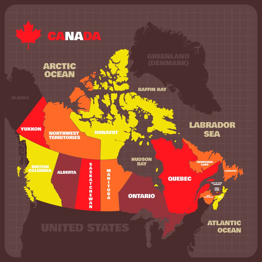
Provinces and Territories of Canada
On the map, the country is clearly divided into 10 provinces and 3 territories. Each of these regions has its own governing bodies and a special status within the federation.
Provinces of Canada
- Ontario (capital — Toronto)
- Quebec (capital — Quebec City)
- British Columbia (capital — Victoria)
- Alberta (capital — Edmonton)
- Manitoba (capital — Winnipeg)
- Saskatchewan (capital — Regina)
- Nova Scotia (capital — Halifax)
- New Brunswick (capital — Fredericton)
- Prince Edward Island (capital — Charlottetown)
- Newfoundland and Labrador (capital — St. John's)
Territories of Canada
- Yukon (administrative center — Whitehorse)
- Northwest Territories (administrative center — Yellowknife)
- Nunavut (administrative center — Iqaluit)
Capital Region
A special place on the map is occupied by the country's capital, Ottawa, located in the province of Ontario. Together with the city of Gatineau in the province of Quebec, it forms the National Capital Region, which is the administrative center of the state.
Features of Administrative Organization
Canada's administrative division has the following distinctive features:
- Asymmetric federalism with different status for provinces and territories
- Broad autonomy of provinces in matters of internal governance
- Special status of Quebec province with a predominantly French-speaking population
- Self-government of territories taking into account the interests of indigenous peoples
Regional Features
On the map of Canada's administrative division, several large regions can be distinguished:
- Atlantic provinces (eastern coast)
- Central Canada (Ontario and Quebec)
- Prairie provinces (Manitoba, Saskatchewan, Alberta)
- Pacific region (British Columbia)
- Northern territories (Yukon, Northwest Territories, Nunavut)
Population Distribution
Canada's administrative division reflects the uneven distribution of Canada's population:
- More than 60% of Canada's population lives in Ontario and Quebec provinces
- Northern territories are the least densely populated
- Most of the population is concentrated in the south of the country
- The largest urban agglomerations are located in the provinces
Canada's Largest Cities
Capital of Canada
Ottawa is the capital of Canada, located in the eastern part of Canada in the province of Ontario. On the map of Canada's cities, you can see its strategic location:
- It is located on the Ottawa River, on the border between Ontario and Quebec provinces
- It is the fourth largest city in the country
- It is part of the National Capital Region
- It is located approximately 400 km from Toronto
Major Economic Centers
Toronto
The largest city in Canada and its financial center:
- The agglomeration population exceeds 6 million people
- Located on the northwestern shore of Lake Ontario in the south of Canada
- The country's largest financial and business center
- A major transportation hub
Montreal
Canada's second largest city:
- The largest city in Quebec province
- An important cultural and economic center
- Located on an island at the confluence of the Saint Lawrence and Ottawa Rivers
- The largest French-speaking city outside of France
Vancouver
The largest city on Canada's west coast:
- The country's main seaport
- An important center of trade with Asia and European countries
- One of the world's most scenic cities
- The third largest city in the country
Largest Population Centers by Region
Western Canada
- Calgary (Alberta) — center of the oil industry
- Edmonton (Alberta) — administrative center of the Canadian province
- Victoria (British Columbia) — capital of the province
- Winnipeg (Manitoba) — major transportation hub
Central Canada
- Quebec City (Quebec) — historical capital of French-speaking Canada
- Hamilton (Ontario) — major industrial center
- Mississauga (Ontario) — fast-growing suburb of Toronto
- Gatineau (Quebec) — part of the capital region
Atlantic Canada
- Halifax (Nova Scotia) — the largest city in the region
- St. John's (Newfoundland and Labrador) — the most eastern city
- Fredericton (New Brunswick) — educational center
- Charlottetown (Prince Edward Island) — historical center
Northern Territories
- Whitehorse (Yukon) — the largest city in Canada's North
- Yellowknife (Northwest Territories) — center of the mining industry
- Iqaluit (Nunavut) — important administrative center
Features of Canada's Physical Map
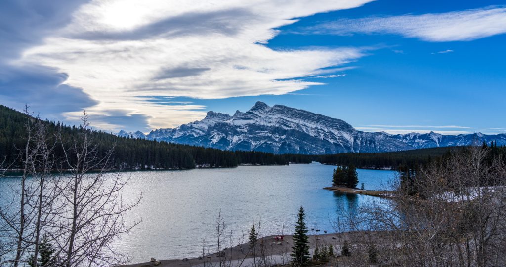
Relief of Canada
On the physical map, several major geographic regions are clearly distinguished:
Mountain Systems
Cordillera in the west:
- Coastal ranges
- Rocky Mountains
- Columbia Mountains
Appalachians in the east:
- Notre-Dame Mountains
- Shickshock Mountains
- White Mountains
Plains and Lowlands
Great Plains:
- Prairie provinces
- Prairies
- Interior plains
Laurentian Lowland:
- Saint Lawrence River valley
- Great Lakes region
Water Resources
Largest Lakes
Great Lakes (partially):
- Lake Superior
- Lake Huron
- Lake Erie
- Lake Ontario
Interior Lakes:
- Great Bear Lake
- Great Slave Lake
- Lake Winnipeg
- Lake Athabasca
Major Rivers
- Saint Lawrence River
- Mackenzie River
- Fraser River
- Saskatchewan River
- Nelson River
Natural Zones
Major Natural Zones from North to South
Arctic Desert:
- Canadian Arctic Archipelago
- Northern coast
Tundra:
- Mainland tundra
- Forest tundra
Boreal Forests:
- Boreal forests
- Canadian Shield
Mixed Forests:
- Lacustrine regions
- Atlantic territories
Steppes:
- Prairies in the south of the country
- Interior plains
Natural Resources by Region
Oil and Gas:
- Alberta
- Saskatchewan
- Atlantic Ocean shelf
Mineral Resources (including Nickel):
- Canadian Shield
- Cordillera
- Northern territories
Canada in the Context of North America
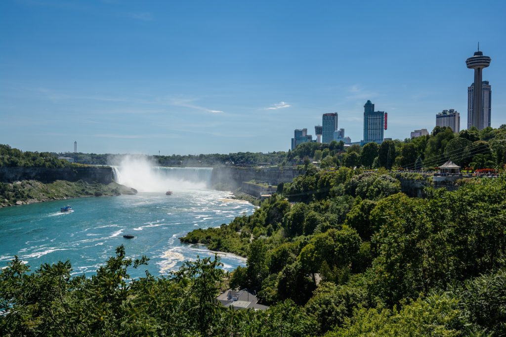
Relations with the USA
On the map of North America, Canada is the largest neighbor of the USA with the world's longest peaceful border. Their relationship is characterized by the following features:
Border Features
- Land border length — 8,891 km
- 49th parallel as the main border line
- Border passes through the Great Lakes
- Alaska has a separate border with Canada
Economic Integration
- Largest trading partners
- USMCA agreement (formerly NAFTA)
- Integrated production chains
- Mutual investment in the economy
Strategic Position
Geographic Advantages
- Control over Arctic territories
- Access to three oceans
- Rich natural resources
- Diversity of climate zones
Role on the Continent
- Second largest country by area on the North American continent
- Important participant in NORAD (air defense)
- Key partner in Arctic development
- Mediator between the USA and other countries
Border Features
Maritime Borders
Pacific Coast:
- Border with the USA in the Juan de Fuca Strait
- Disputed waters with Alaska
Atlantic Coast:
- Gulf of Maine
- Davis Strait
Arctic Coast:
- Beaufort Sea
- Northwest Passage
Transboundary Regions
- Great Lakes
- Saint Lawrence River
- Niagara Falls
- Rocky Mountains
International Cooperation
Main Agreements
Trade Agreements:
- USMCA
- Bilateral agreements
Environmental Agreements:
- Protection of the Great Lakes
- Protection of migratory species
Defense Treaties:
- NORAD
- NATO
Types of Maps of Canada and Their Application
Political Map
Main Characteristics
The political map displays:
Administrative Division of the Country:
- Provincial boundaries
- Territorial boundaries
- Capitals of provinces and territories
Population Centers:
- Major cities
- Administrative centers
- Important transportation hubs
Application
- Educational purposes
- Administrative planning
- Government administration
- International relations
Physical Map
Elements Displayed
Terrain:
- Mountain systems
- Plains
- Lowlands
Water Objects:
- Rivers and lakes
- Bays and straits
- Oceans
Areas of Application
- Scientific research
- Environmental monitoring
- Resource planning
- Tourism industry
Administrative Map
Map Contents
Internal Division:
- Provincial boundaries
- Territorial boundaries
- Municipal entities
Infrastructure:
- Transportation networks
- Administrative centers
- Important facilities
Economic Map
Key Elements
Natural Resources:
- Mineral deposits
- Forest resources
- Agricultural lands
Industry:
- Industrial centers
- Mining regions
- Economic zones
Purpose
- Economic planning
- Investment analysis
- Regional development
- Business strategies
Specialized Maps
Types
Climate Maps:
- Temperature zones
- Precipitation
- Climate zones
Demographic Maps:
- Population density of Canada
- Ethnic composition
- Migration flows
Environmental Maps:
- Protected areas
- Ecological zones
- Natural hazards
Conclusion
Significance of Geographic Location for Country Development
Economic Advantages
Natural Resources:
- Extensive forest areas
- Rich mineral deposits
- Significant freshwater reserves
- Extensive agricultural lands
Transportation Opportunities:
- Access to three oceans
- Developed system of internal waterways
- Strategic seaports
Political Significance
International Relations:
- Control over Arctic territories
- Strategic partnership with the USA
- Participation in international organizations
Security:
- Natural geographic barriers
- Control over important maritime routes
- Strategic position in the Arctic
Canada's Modern Role in the World
International Influence
Economic Cooperation:
- Participation in the G7
- Member of NATO
- Important trading partner of many countries
Environmental Role:
- Conservation of natural resources
- Protection of Arctic territories
- Fighting climate change
Development Prospects
Economic Opportunities
- Development of Arctic resources
- Innovative technologies
- Green energy
Geopolitical Advantages
- Strengthening the role in the Arctic region
- Development of international cooperation
- Strengthening regional ties
Overall Conclusions
Canada's geographic position on the world map determines its unique advantages and development opportunities:
- Strategic location between three oceans
- Wealth of natural resources due to extensive territory
- Favorable proximity to the world's largest economy
- Key role in Arctic development
- Potential for further economic growth
- Opportunities for developing international cooperation


