Norway on the Map: A Complete Guide to the Country's Location
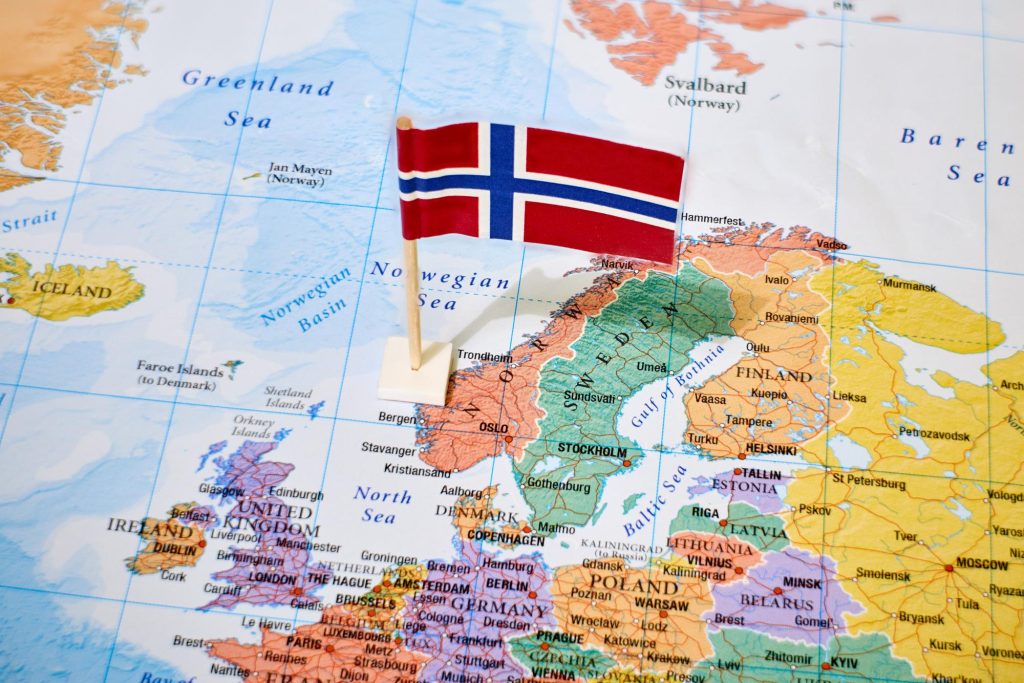
Norway on the map: where the country is located, its elongated form along the Atlantic, fjords and extent from south to north.

The Kingdom of Norway (Norge) is one of the northernmost countries in Europe, located in the western part of the Scandinavian Peninsula. This Scandinavian nation, which is a constitutional monarchy, attracts attention not only for its natural beauty but also for its unique geographical position, which has largely determined its historical development and current status.
On the world map, Norway stands out for its characteristic elongated form along the Atlantic coast. The map of Norway shows that the country occupies the western part of the peninsula, stretching from south to north for more than 1,700 km. This position makes Norway one of the most extended countries in Europe.
Key features of the location:
- Occupies the western and polar parts of the Scandinavian Peninsula
- Has access to three seas: the North Sea, the Norwegian Sea and the Barents Sea
- Is located partly beyond the Arctic Circle
- Is part of the Northern Europe region
Norway's geographical position played a key role in shaping its culture, economy and way of life. The extended coastline, carved by numerous fjords, gave the country the status of one of the leading maritime powers. Its location beyond the Arctic Circle has given the country a unique natural phenomenon – the midnight sun and polar night, making Norway particularly attractive to tourists from around the world.
Norway's geographical location
This country in Northern Europe is located between 57° and 71° north latitude and between 4° and 31° east longitude. Norway occupies the western part of the Scandinavian Peninsula, as well as the Svalbard Archipelago, Jan Mayen Island and Bouvet Island in the Southern Hemisphere.
Main geographical characteristics:
- Total extent from south to north: 1,752 km
- Northernmost point of the mainland: North Cape (71°10′21″ N)
- Southernmost point: Lindesnes Cape (57°58′40″ N)
- Easternmost point: Grense-Jakobselv River (31°10′04″ E)
- Westernmost point: Holmene Island (4°30′13″ E)
Position relative to the continents
Located in the European north, Norway is part of the Scandinavian region. On the world map, the country is located in the subpolar zone, where a significant part of its territory is beyond the Arctic Circle. This determines unique natural phenomena such as the midnight sun and polar night.
Membership in the Northern Europe region
As part of Europe, Norway is one of the key countries in the region. The country is a member of:
- The Scandinavian region
- The pan-European economic area
- The Arctic Council
- The Council of the Baltic Sea States
Maritime position
The distinctive feature of Norway's geographical location is its access to three seas:
- The North Sea in the southwest
- The Norwegian Sea in the west
- The Barents Sea in the north
The extended coastline, carved by fjords, stretches for more than 25,000 km, making the country one of the most "maritime" states in Europe.
Borders and neighboring countries
Land borders
Norway shares land borders with three countries, with a total length of 2,542 km:
- Sweden — the longest border (1,619 km), running along the eastern part of the country. Norway shares a border with Sweden along the entire eastern part of the mainland
- Finland — border in the northeast (727 km)
- Russia — the shortest border (196 km) in the far northeast
Features of border areas:
- Mountains along the Swedish border
- Tundra landscapes on the border with Finland and Russia
- Border river Grense-Jakobselv between Norway and Russia
Maritime borders
Norway's coastline is one of the longest in the world and stretches for 25,148 km, including fjords and islands. The country has maritime borders in:
- The North Sea — borders the territorial waters of the United Kingdom and Denmark
- The Norwegian Sea — access to the open ocean
- The Barents Sea — maritime border with Russia
Features of the coastline
The Norwegian coast is characterized by:
- Numerous fjords cutting into the mainland for tens of kilometers
- More than 50,000 islands, including the Svalbard Archipelago
- A complex configuration of the coastline with numerous bays and inlets
- The presence of convenient natural harbors
The significance of the border position
Norway's location on the map and the nature of its borders determine:
- Active participation in pan-European integration
- Development of international transport corridors
- A special role in Arctic cooperation
- Strategic significance in the European security system
Features of the territory
Total area
Norway covers a total area of 385,207 km², of which:
- Mainland: 323,802 km²
- Svalbard Archipelago: 61,022 km²
- Jan Mayen Island: 377 km²
- Bouvet Island: 49 km²
By territory size, the country ranks 67th in the world and 6th among European countries.
Terrain
Norwegian territory is characterized by diverse terrain:
- Mountains and plateaus occupy about 70% of the territory
- The Scandinavian Mountains (Norwegian Mountains) stretch for 1,700 km
- Highest point — Galdhøpiggen Mountain (2,469 m)
- Lowlands account for less than 30% of the territory
Distinctive geographical features
Fjords
Norwegian fjords are the country's signature:
- Sognefjord — the longest (204 km)
- Hardangerfjord — the second largest (179 km)
- Geirangerfjord — a UNESCO World Heritage Site
Glaciers
The country is home to about 1,600 glaciers:
- Jostedalsbreen — the largest glacier in continental Europe
- Svartisen — the second largest glacier in Norway
- Folgefonna — the third largest glacier mass
Plateaus and plains
Main plateaus:
- Hardangervidda — the largest high-altitude plateau in Europe
- Finnmarksvidda — a plateau in the polar part of the country
- Dovre — a mountain plain in the central part
Impact of terrain on the country's development
The territory's characteristics determine:
- The pattern of population distribution (concentration in coastal areas)
- Development of transportation infrastructure (predominance of maritime and air transport)
- Economic specialization (development of hydroelectric power, fishing)
- Tourist appeal (nature and ecological tourism)
Administrative divisions
Main regions
As of January 1, 2020, Norway is divided into 11 fylker (counties):
- Troms og Finnmark (largest by area, includes the Troms and Finnmark regions)
- Nordland
- Trøndelag
- Møre og Romsdal
- Vestland
- Rogaland
- Agder
- Vestfold og Telemark (combines the Vestfold and Telemark regions)
- Viken (includes the former counties of Akershus, Buskerud and Østfold)
- Oslo (capital region)
- Innlandet (combines the former Hedmark and Oppland)
Major cities
The main urban centers of Norway:
Oslo — capital and largest city (681,000 residents)
- Political and economic center
- Located in the south of Norway on the Oslo Fjord
- A major transport hub
Bergen (283,000 residents)
- Second largest city
- Main port of the western coast
- Historic trade center
Trondheim (205,000 residents)
- An important scientific and technological center
- Historic city of the Vikings
- Center of the Trøndelag region
Stavanger (133,000 residents)
- Center of the oil industry
- Major port in the southwest
- Tourist center
Capital and its location
Oslo, as Norway's capital, has the following characteristics:
Geographical location:
- 59°55′ north latitude
- 10°45′ east longitude
- Located in the southeastern part of the country
Location features:
- Located at the end of the Oslo Fjord
- Surrounded by hills and forests
- Has a natural harbor
Strategic significance:
- The country's main transport hub
- Center of international communications
- Leading economic region
Natural and geographical features
Climate zones
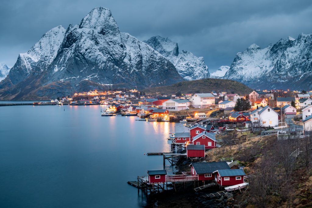
Norway's climate is represented by several zones:
Temperate maritime climate:
- Characteristic of the western coast
- The warm Gulf Stream current ensures mild winters
- High humidity and frequent precipitation
Subarctic climate:
- Predominates in inland areas
- Cold, prolonged winters
- Short, cool summers
Arctic climate:
- Characteristic of polar territories (Northern Norway)
- Midnight sun and polar night
- Extremely low winter temperatures
Unique natural objects
The following natural attractions are found in Norway:
Fjords:
- Nærøyfjord (listed as a UNESCO site)
- Lysefjord with the famous Preikestolen rock
- Nordfjord with the Briksdalsbreen glacier
Mountain ranges:
- Jotunheimen with the country's highest point
- Trollstigen (the Troll's Ladder)
- Rondane mountain range
Water features:
- Vøringfossen waterfall
- Mjøsa Lake — the largest in the country
- Glomma River — the longest in Norway
Features of the landscape
The Norwegian landscape is characterized by the diversity of natural zones:
Coastal zone:
- An indented coastline
- Numerous islands and skerries
- Sandy beaches in the south
Mountain zone:
- Rocky peaks
- Deep valleys
- Mountain lakes
Tundra zone:
- Widespread in polar regions
- Characteristic vegetation
- Permafrost
Environmental significance
Norway's natural and geographical features determine:
- Rich biodiversity
- The presence of unique ecosystems
- The importance of preserving natural complexes
- Development of ecological tourism
Strategic position
Significance of location for the economy
Norway's geographical position plays a key role in its economic development:
Marine resources:
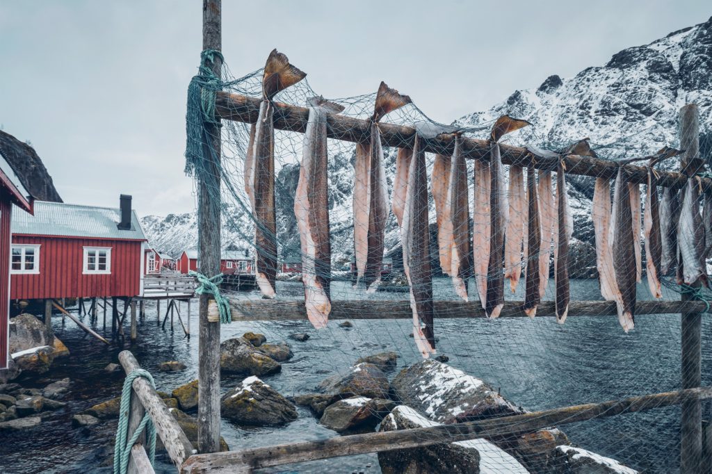
- Access to rich fish resources
- The presence of shelf oil and gas deposits
- Developed aquaculture
Energy potential:
- Large hydroelectric resources reserves
- Potential for wind energy development on the coast
- Opportunities for tidal energy development
International trade:
- Strategic position on maritime trade routes
- Proximity to major European markets
- Control of important sea passages
Transport routes
The country's location determines the development of its transport system:
Maritime routes:
- A developed system of ports along the coast
- Important international maritime routes
- Arctic maritime route
Land communications:
- Rail connection with Sweden
- A developed network of highways
- Mountain tunnels and bridges
Air communications:
- International airports
- A developed network of domestic airlines
- Helicopter service to oil platforms
Role in the region
Strategic position determines Norway's regional significance:
Political influence:
- Participation in the Arctic Council
- Role in Arctic policy
- Cooperation with the EU
Economic cooperation:
- Participation in the European economic area
- Regional economic projects
- Cross-border cooperation
Security:
- Member of NATO
- Control of important maritime routes
- Military-strategic importance for the Arctic
Historical context and culture
Historical development
The history of the nation of Norge is closely linked to its geographical location. In 1814, Norway was transferred to Sweden from Denmark by the Treaty of Kiel, which became an important milestone in the formation of the modern state. Norway's independence was finally achieved in 1905 when the country peacefully separated from Sweden.
Population and language
Norwegians make up the majority of the country's population. The official language is Norwegian, which exists in two written forms: Bokmål and Nynorsk. Nynorsk was created based on rural Norwegian dialects by linguist Ivar Aasen in the 19th century and is used by approximately 10-15% of Norwegians.
Religion and culture
Historically, most Norwegians belonged to the Church of Norway (Evangelical Lutheran Church), which was long the state religion. Evangelical Lutheranism remained the official religion until 2012.
Interesting facts about Norway
Achievements and records
Detailed information on the country's achievements includes the following interesting facts:
- Norway ranks first in the world on the Human Development Index
- The country is the birthplace of the Nobel Peace Prize, which is awarded annually in Oslo
- Norway has demonstrated outstanding results at the Winter Olympic Games
- In 1994, the country hosted the Winter Olympic Games in Lillehammer
Modern achievements
- On the North Sea shelf is Troll A — the world's largest drilling platform
- A detailed map of oil and gas fields shows the country's resource wealth
- In the world atlas, Norway is listed as one of the most developed countries
Cultural heritage
In Oslo, there is a Viking Ship Museum demonstrating the rich maritime heritage of Norwegians. This is just one of many museums telling about the country's culture and history.
Conclusion
Summary of key location features
Norway's geographical location can be characterized as a unique combination of the following factors:
Spatial location:
- Territory extends from south to north for more than 1,700 km
- Located in the western part of the Scandinavian Peninsula
- Has territories beyond the Arctic Circle
Natural features:
- Complex terrain dominated by mountains
- Coastline carved by fjords
- Variety of climate zones
Significance of geographical location for the country's development
Norway's location has determined the following aspects of its development:
Economic potential:
- Access to marine and energy resources
- Development of maritime trade and fishing
- Opportunities for tourism development
Social development:
- Features of population distribution
- Formation of a unique culture
- Adaptation to natural conditions
International significance:
- Strategic role in the European region
- Participation in international organizations
- Influence on Arctic policy
Prospects and opportunities
Norway's geographical location continues to open new opportunities:
- Development of "green" energy
- Development of Arctic resources
- Strengthening international cooperation
- Development of innovative sectors of the economy
Thus, Norway's geographical position is a key factor determining its unique place in the world. The combination of natural conditions, strategic location and resource potential provides a foundation for the country's Norge sustainable development and its important role in international relations.